


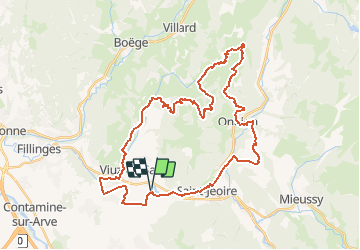
Lac - Onnion - Plaine-Joux - Le Déluge - Lac

HG74250
User

Length
40 km

Max alt
1411 m

Uphill gradient
1320 m
Km-Effort
58 km

Min alt
578 m

Downhill gradient
1319 m
Boucle
Yes
Creation date :
2020-02-12 19:12:35.791
Updated on :
2020-02-12 19:29:07.181
2h54
Difficulty : Very difficult

FREE GPS app for hiking
 SityTrail
IGN / Geographical institutes
SityTrail Plus
The world is yours!
About
Trail Mountain bike of 40 km to be discovered at Auvergne-Rhône-Alpes, Upper Savoy, La Tour. This trail is proposed by HG74250.
Positioning
Country:
France
Region :
Auvergne-Rhône-Alpes
Department/Province :
Upper Savoy
Municipality :
La Tour
Location:
Unknown
Start:(Dec)
Start:(UTM)
300726 ; 5112746 (32T) N.
Comments